با فاصله نزدیک
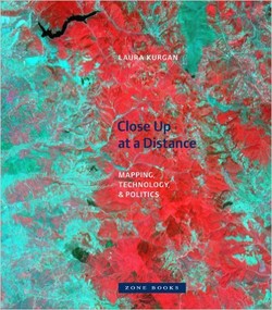
نقشههای موجود در کتاب “با فاصله نزدیک” توسط ماهوارهها گرفته شدهاند، با پیکسلهای مخابرهشده از فضاهای بیرونی مونتاژ شدهاند و از آمارها ساخته شدهاند. آنها شرایط برخوردهای شدید را ضبط میکنند و تحولات اساسی صورتگرفته در روش مشاهده ما از تجربه فضا را بیان میکند. این نقشهها با سیستم تعیین موقعیت جهانی (GPS)، ماهوارههای سنجش از راه دور، یا سیستم اطلاعات جغرافیایی (GIS): سختافزار و نرمافزار فضاهای دیجیتالی طراحیشده برای کاربردهای نظامی و دولتی جهت شناسایی، پنهانکاری، نظارت، پرتابه، سرشماری و امنیت ملی، گرفته شدهاند. Laura Kurgan بهجای دوری از سیاستها و پیچیدگیهای کاربردهای این ابزار، سعی در شفافسازی آنها دارد.
سال انتشار: 2013 | 232 صفحه | حجم فایل: 20 مگابایت | زبان: انگلیسی
Close Up at a Distance: Mapping, Technology, and Politics
نویسنده
Laura Kurgan
ناشر
Zone Books
ISBN10:
1935408283
ISBN13:
9781935408284
قیمت: 16000 تومان
برچسبها:عناوین مرتبط:


The maps in this book are drawn with satellites, assembled with pixels radioed from outer space, and constructed from statistics; they record situations of intense conflict and express fundamental transformations in our ways of seeing and of experiencing space. These maps are built with Global Positioning Systems (GPS), remote sensing satellites, or Geographic Information Systems (GIS): digital spatial hardware and software designed for such military and governmental uses as reconnaissance, secrecy, monitoring, ballistics, the census, and national security. Rather than shying away from the politics and complexities of their intended uses, in Close Up at a Distance Laura Kurgan attempts to illuminate them. Poised at the intersection of art, architecture, activism, and geography, her analysis uncovers the implicit biases of the new views, the means of recording information they present, and the new spaces they have opened up.
Her presentation of these maps reclaims, repurposes, and discovers new and even inadvertent uses for them, including documentary, memorial, preservation, interpretation, political, or simply aesthetic. GPS has been available to both civilians and the military since 1991; the World Wide Web democratized the distribution of data in 1992; Google Earth has captured global bird’s-eye views since 2005. Technology has brought about a revolutionary shift in our ability to navigate, inhabit, and define the spatial realm. The traces of interactions, both physical and virtual, charted by the maps in Close Up at a Distance define this shift.