تصویرسازی یکپارچه زمین؛ تئوری و کاربردها
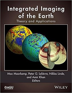
یکی از مهمترین و حساسترین موضوعات در بحث علوم زمین، داشتن اطلاعات دقیق و قابل اطمینان است. یکپارچهسازی کمی دادههای ژئوفیزیکی و جغرافیایی، مدلهای توصیفکننده زمین را مطمئنتر و قویتر میسازد.
هدف کتاب حاضر، ارائه خلاصهای از تحقیقات روزافزون در زمینه ترکیب انواع دادههای ژئوفیزیکی و دیگر علوم مربوط به زمینشناسی است. روشهای توسعهیافته وارونگیها و نیز روش تحلیل پسوارونگی آماری را، که هر کدام مزایا و فرضیات بخصوصی دارند، شامل میباشند. این کتاب، که با مباحث مربوط به اصول ابتدایی تئوری وارونگی آغاز میشود، بهطور سیستماتیک، جنبههای فرضی و ریاضیاتی در مورد چگونگی یکپارچهسازی دادههای مختلف ژئوفیزیکی با دادههای تفسیری و اطلاعات جفرافیایی پیشین را توصیف میکند.
هر فصل توسط فردی متخصص در آن زمینه نگاشته شده، که موجب شده است کتاب حاضر منبعی متفاوت در زمینه تصویرسازی یکپارچه زمین باشد.
سال انتشار: 2016 | 270 صفحه | حجم فایل: 13 مگابایت | زبان: انگلیسی
Integrated Imaging of the Earth: Theory and Applications (Geophysical Monograph Series)
نویسنده
Max Moorkamp
ناشر
American Geophysical Union
ISBN10:
1118929055
ISBN13:
9781118929056
قیمت: 16000 تومان
برچسبها: ژئوفیزیک
Reliable and detailed information about the Earth’s subsurface is of crucial importance throughout the geosciences. Quantitative integration of all available geophysical and geological data helps to make Earth models more robust and reliable. The aim of this book is to summarize and synthesize the growing literature on combining various types of geophysical and other geoscientific data. The approaches that have been developed to date encompass joint inversion, cooperative inversion, and statistical post-inversion analysis methods, each with different benefits and assumptions.
Starting with the foundations of inverse theory, this book systematically describes the mathematical and theoretical aspects of how to best integrate different geophysical datasets with geological prior understanding and other complimentary data. This foundational basis is followed by chapters that demonstrate the diverse range of applications for which integrated methods have been used to date. These range from imaging the hydrogeological properties of the near-surface to natural resource exploration and probing the composition of the lithosphere and the deep Earth. Each chapter is written by leading experts in the field, which makes this book the definitive reference on integrated imaging of the Earth.
Highlights of this volume include:
Complete coverage of the theoretical foundations of integrated imaging approaches from inverse theory to different coupling methods and quantitative evaluation of the resulting models
Comprehensive overview of current applications of integrated imaging including hydrological investigations, natural resource exploration, and imaging the deep Earth
Detailed case studies of integrated approaches providing valuable guidance for both experienced users and researchers new to joint inversion.
This volume will be a valuable resource for graduate students, academics, industry practitioners, and researchers who are interested in using or developing integrated imaging approaches.
