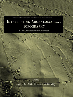
تفسیر توپوگرافی باستان شناسی؛ داده های سه بعدی، تجسم و مشاهده
سال انتشار: 2013 | 281 صفحه | حجم فایل: 224 مگابایت | زبان: انگلیسی
Interpreting Archaeological Topography: 3D Data, Visualisation and Observation (Occasional Publication of the Aerial Archaeology Research Gr)
نویسنده
Rachel S. Opitz, David C. Cowley
ناشر
Oxbow Books
ISBN10:
1842175165
ISBN13:
9781842175163
قیمت: 16000 تومان
برچسبها:عناوین مرتبط:


Airborne Laser Scanning (ALS), or lidar, is an enormously important innovation for data collection and interpretation in archaeology. The application of archaeological 3D data deriving from sources including ALS, close-range photogrammetry and terrestrial and photogrammetric scanners has grown exponentially over the last decade. Such data present numerous possibilities and challenges, from ensuring that applications remain archaeologically relevant, to developing practices that integrate the manipulation and interrogation of complex digital datasets with the skills of archaeological observation and interpretation. This volume addresses the implications of multi-scaled topographic data for contemporary archaeological practice in a rapidly developing field, drawing on examples of ongoing projects and reflections on best practice. Twenty papers from across Europe explore the implications of these digital 3D datasets for the recording and interpretation of archaeological topography, whether at the landscape, site or artifact scale. The papers illustrate the variety of ways in which we engage with archaeological topography through 3D data, from discussions of its role in landscape archaeology, to issues of context and integration, and to the methodological challenges of processing, visualization and manipulation. Critical reflection on developing practice and implications for cultural resource management and research contextualize the case studies and applications, illustrating the diverse and evolving roles played by multi-scalar topographic data in contemporary archaeology.