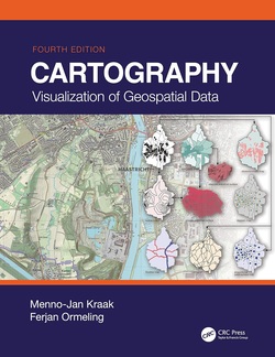
نقشه برداری با آرک جی آی اس پرو؛ طراحی نقشه های دقیق و کاربر پسند برای به اشتراک گذاری داستان داده ها

سال انتشار: 2018 | 259 صفحه | حجم فایل: 22 مگابایت | زبان: انگلیسی
Mapping with ArcGIS Pro: Design accurate and user-friendly maps to share the story of your data
نویسنده
Amy Rock, Ryan Malhoski
ناشر
Packt Publishing
ISBN10:
1788298004
ISBN13:
9781788298001
قیمت: 16000 تومان
برچسبها: آرک جی آی اس جی آی اسعناوین مرتبط:


Implementing the ArcGIS Pro technique to design accurate, user friendly maps and making appropriate cartographic decisions
Key Features
Build visually stunning and useful maps;
Understand the cartographic workflows and the decisions you must take before creating the map;
Learn to create appropriate map elements and layout designs
Use the ArcGIS Online's Smart Mapping technique to create clear webmaps
Book Description
ArcGIS Pro is a geographic information system for working with maps and geographic information. This book will help you create visually stunning maps that increase the legibility of the stories being mapped and introduce visual and design concepts into a traditionally scientific, data-driven process. The book begins by outlining the steps of gathering data from authoritative sources and lays out the workflow of creating a great map. Once the plan is in place you will learn how to organize the Contents Pane in ArcGIS Pro and identify the steps involved in streamlining the production process. Then you will learn Cartographic Design techniques using ArcGIS Pro's feature set to organize the page structure and create a custom set of color swatches. You will be then exposed to the techniques required to ensure your data is clear and legible no matter the size or scale of your map. The later chapters will help you understand the various projection systems, trade-offs between them, and the proper applications of them to make sure your maps are accurate and visually appealing. Finally, you will be introduced to the ArcGIS Online ecosystem and how ArcGIS Pro can utilize it within the application. You will learn Smart Mapping, a new feature of ArcGIS Online that will help you to make maps that are visually stunning and useful.
By the end of this book, you will feel more confident in making appropriate cartographic decisions.
What you will learn
Using ArcGIS Pro to create visually stunning maps and make confident cartographic decisions
Leverage precise layout grids that will organize and guide the placement of map elements
Make appropriate decisions about color and symbols
Critically evaluate and choose the perfect projection for your data
Create clear webmaps that focus the reader’s attention using ArcGIS Online’s Smart Mapping capabilities
Who This Book Is For
If you are a GIS analyst or a Map designer who would like to create and design a map with ArcGIS Pro then this book is for you. A basic GIS knowledge is assumed.
Table of Contents
How Maps Get Made
Getting Started in ArcGIS Pro
Organizing the Page Structure
Typographic Principles
Picking Colors with Confidence
All Maps Are Approximations of Reality
Understanding and Choosing Projections
Clean Symbology and Uncluttered Maps
Getting Started with ArcGIS Online
Leveraging Esri Smart Mapping